- about -
Avery Kolenski is a GIS specialist working out of Montreal, QC studying Public Policy & Public Administration out of Concordia University. She is passionate about cartographic design, spatial analytics, and solving problems through a geographic lens.
Examples of maps created in both ArcGIS Pro and QGIS are provided below, accompanied by example problems that can be answered by GIS to showcase the applications of geospatial thinking.
For more information please reach out on LinkedIn.
- portfolio -
What if you needed to know whether Amherst, Massachusetts was comprised more of sand/gravel or more of alluvium?
What is the soil makeup of Amherst, MA?
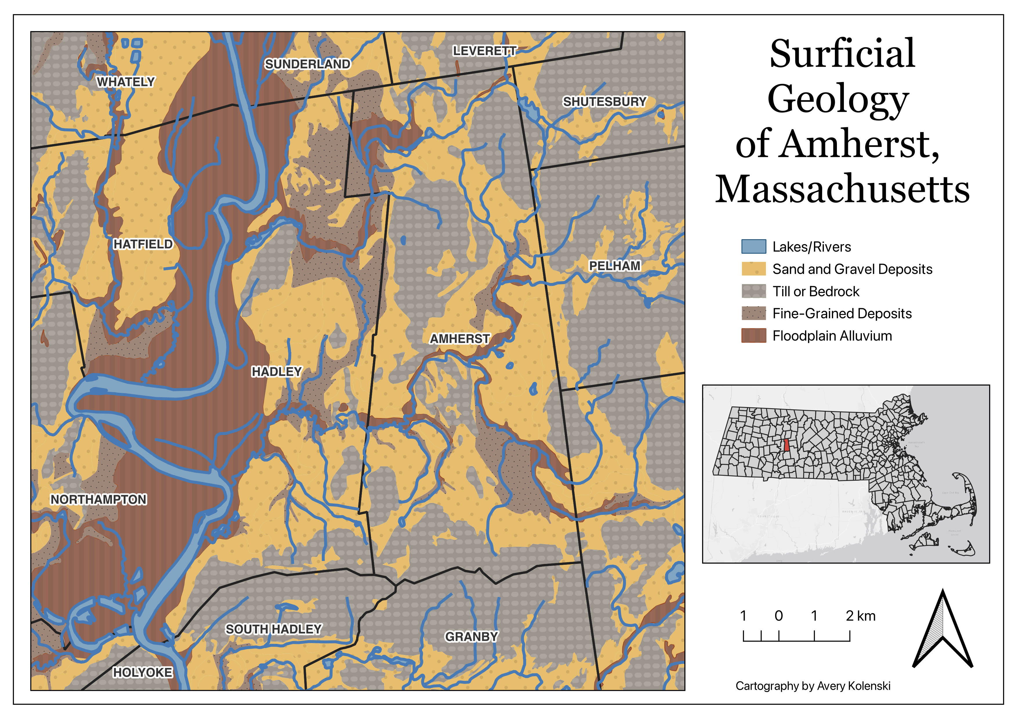
Made in QGIS
What if you were interested in how income varies across space in the state of Massachusetts?
What is the median household income by census tract?
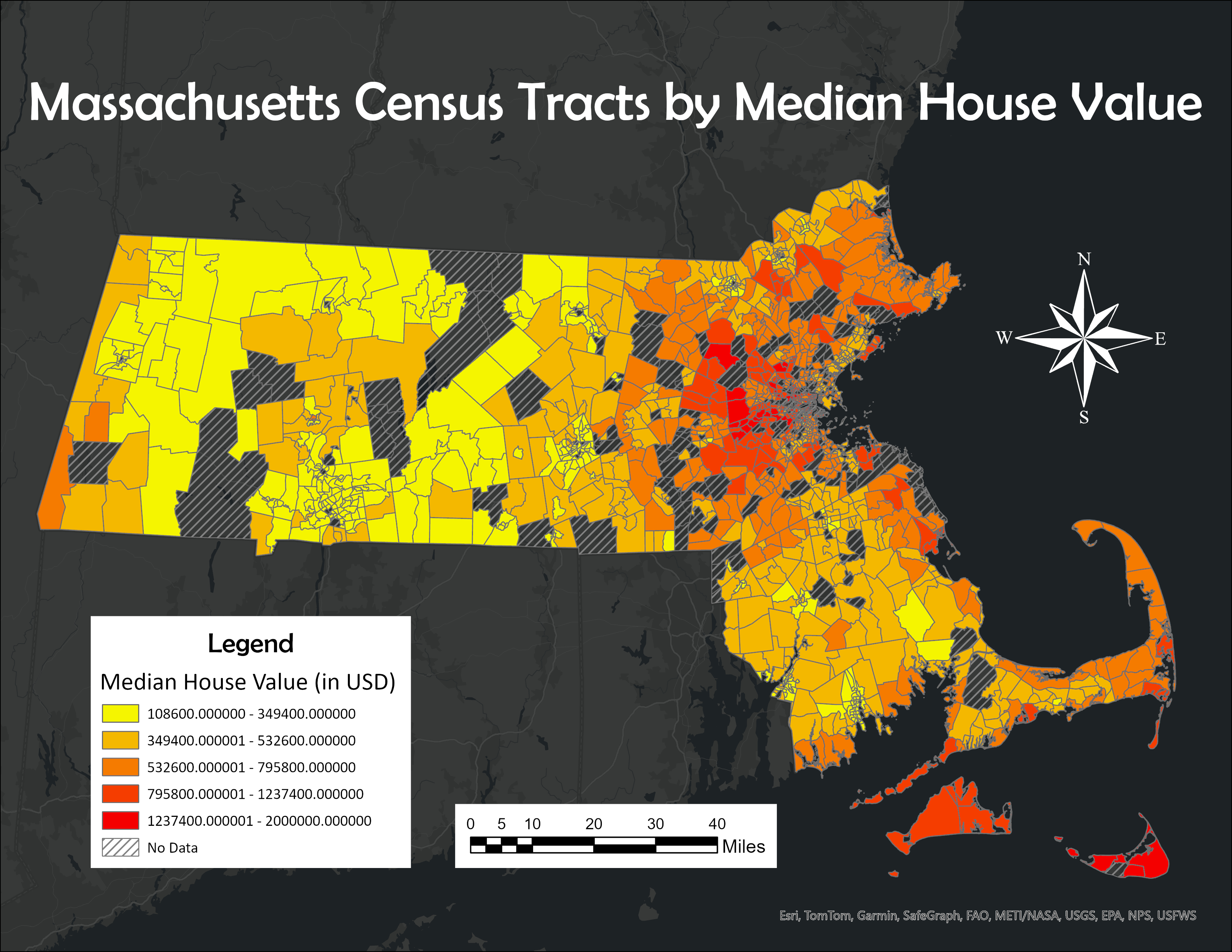
Made in ArcGIS Pro
What if you needed to evaluate possible sites for a new landfill based on geological conditions?
What areas have the highest concentration of desireable site qualities, weighted by importance?
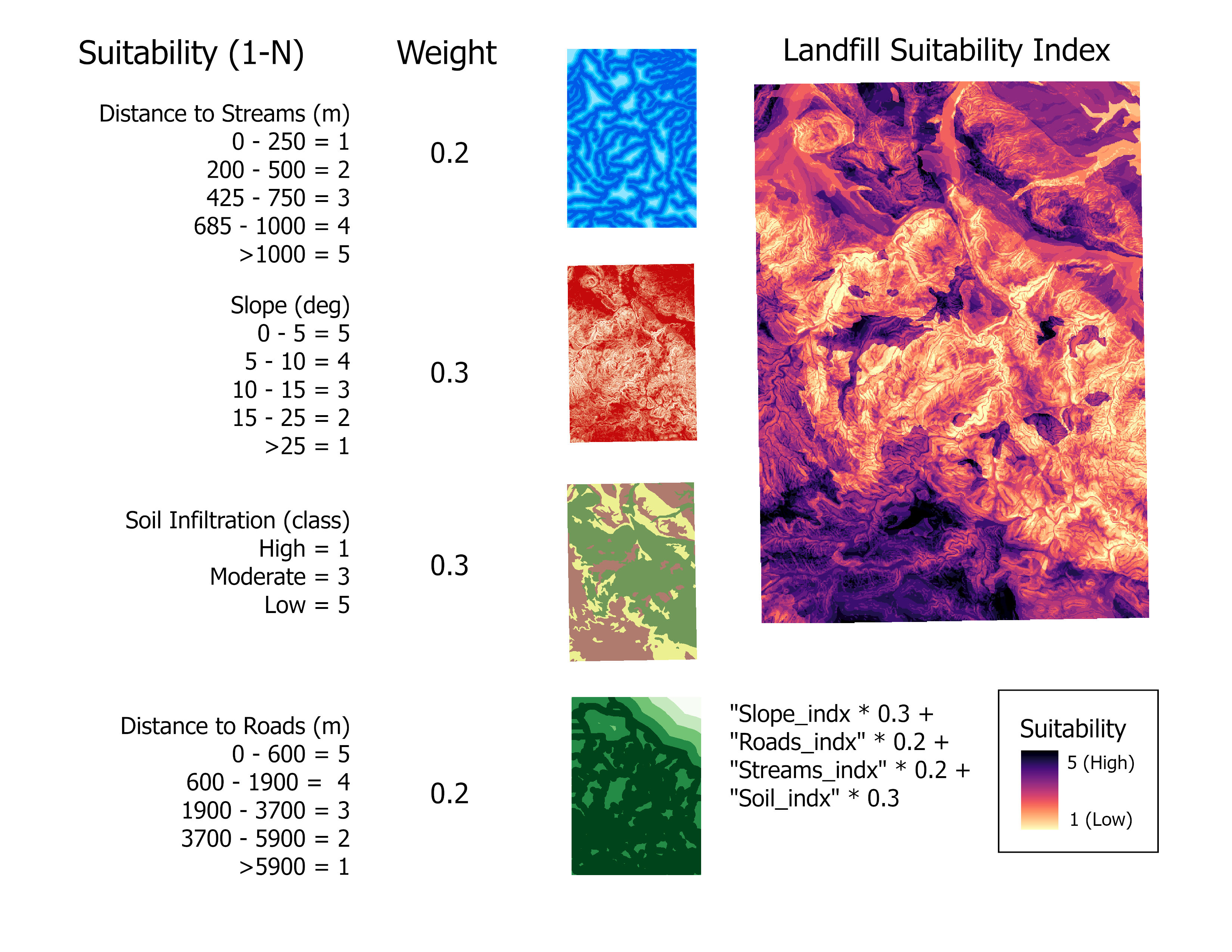
Made in ArcGIS Pro
What if you needed to know how much land in Amherst, Massachusetts is forested vs. how much is cropland?
What is the land use distribution of Amherst, MA?
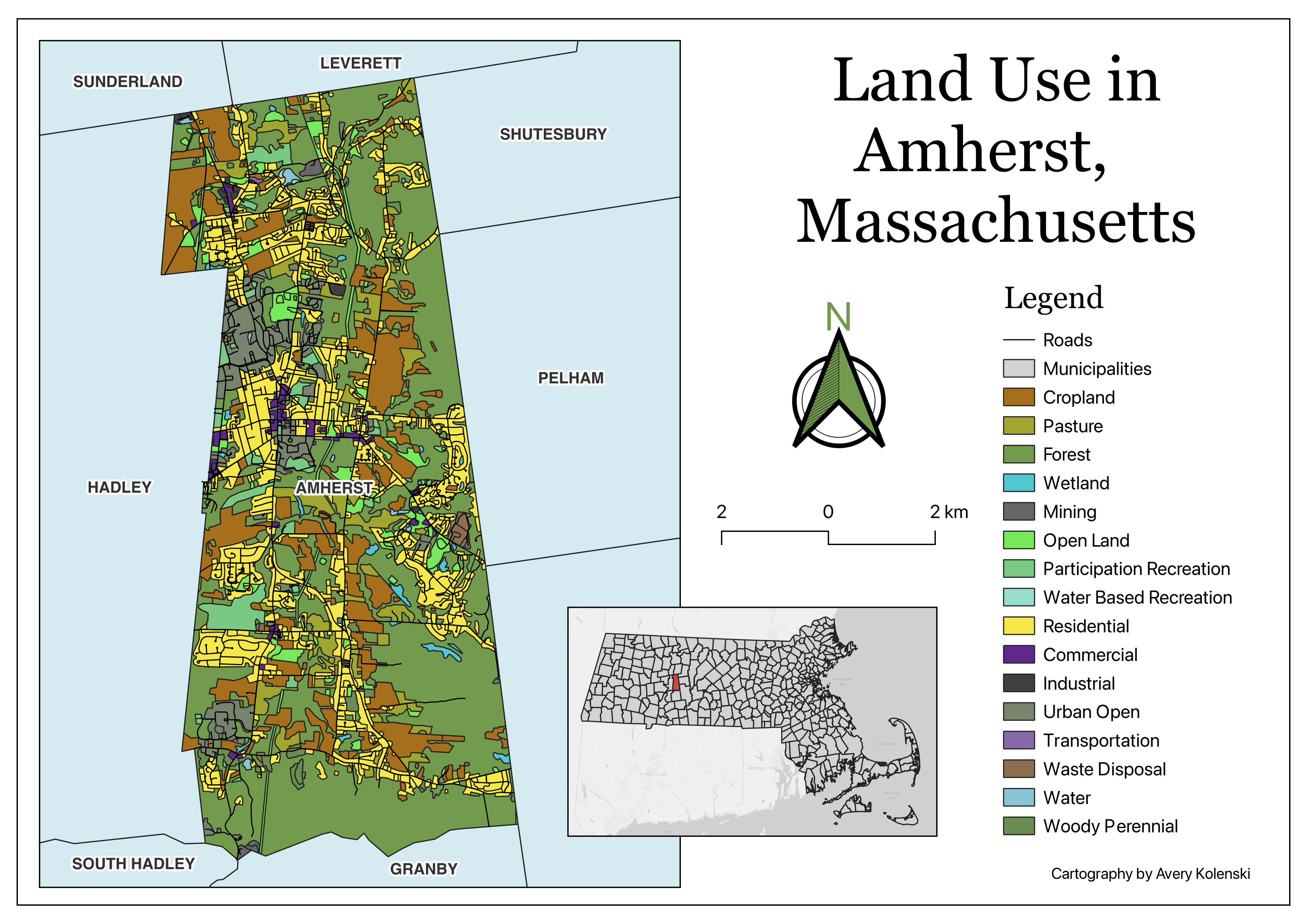
Made in QGIS
What if you wanted to know where to invest in land for a new farming operation?
Where is the habitable and inhabitable land for agriculture in Australia?
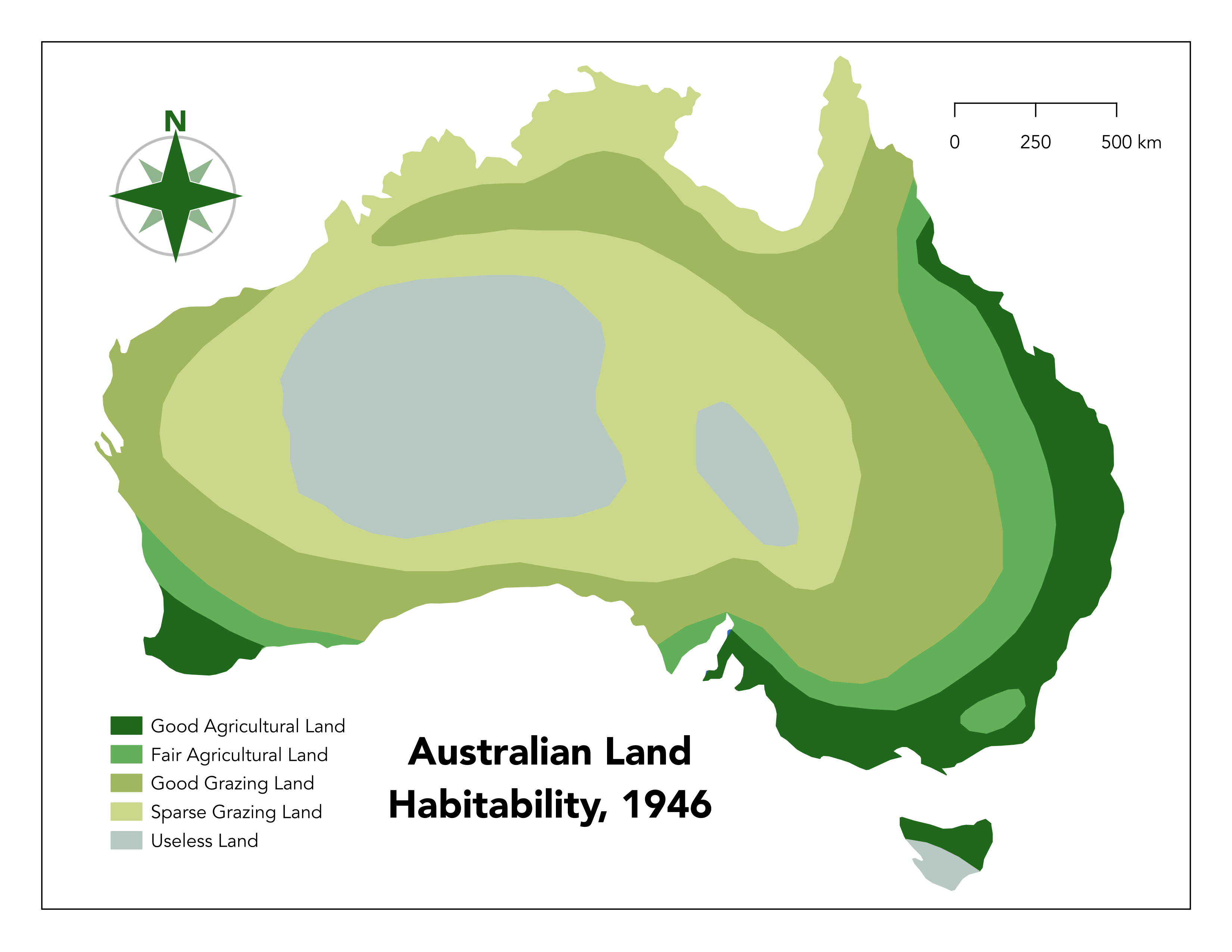
Made in QGIS
What if you wanted to know the vegetation distribution of Australia for an ecological study?
What are the different types and locations of vegetation classifications across Australia?
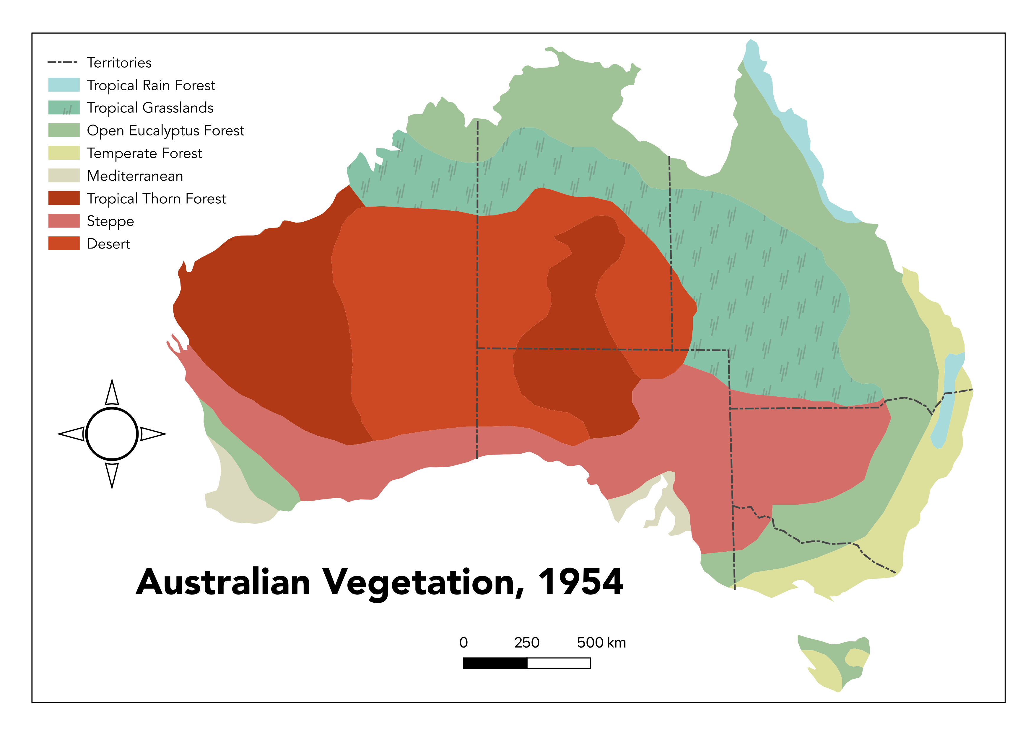
Made in QGIS
What if you needed to spray pesticide within 2 kilometers of a dead bird, but spray from trucks can only reach 50 meters from the road and you cannot spray within 100 meters of a wetland?
How much land fits the conditions required to be sprayable?
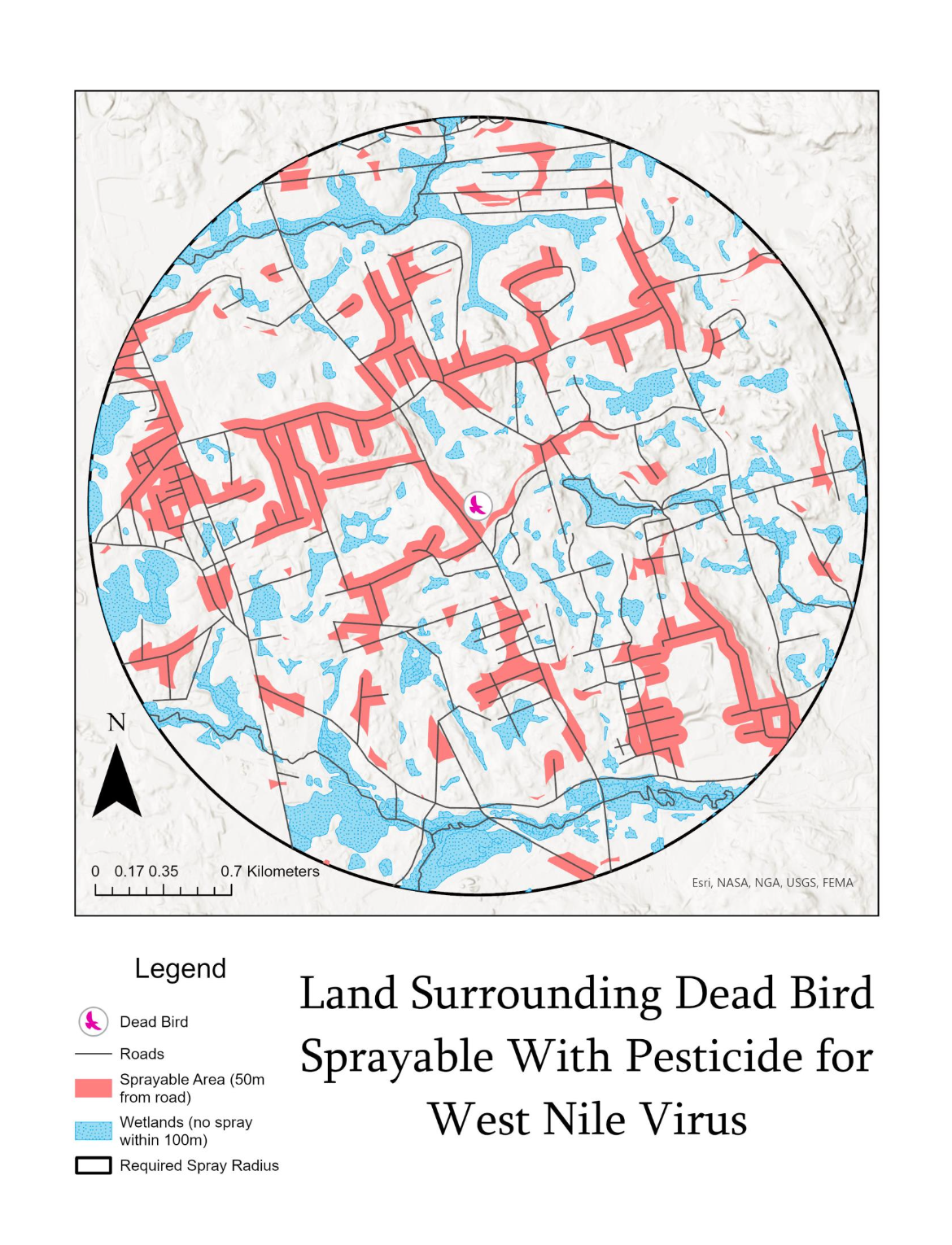
Made in ArcGIS Pro
What if you wanted to know which municipalities in the island of Montreal have the highest concentration of public transit stops and what types of service are available?
Which municipalities have the highest concentration of stops and do they have bus lines, metro lines, or both?
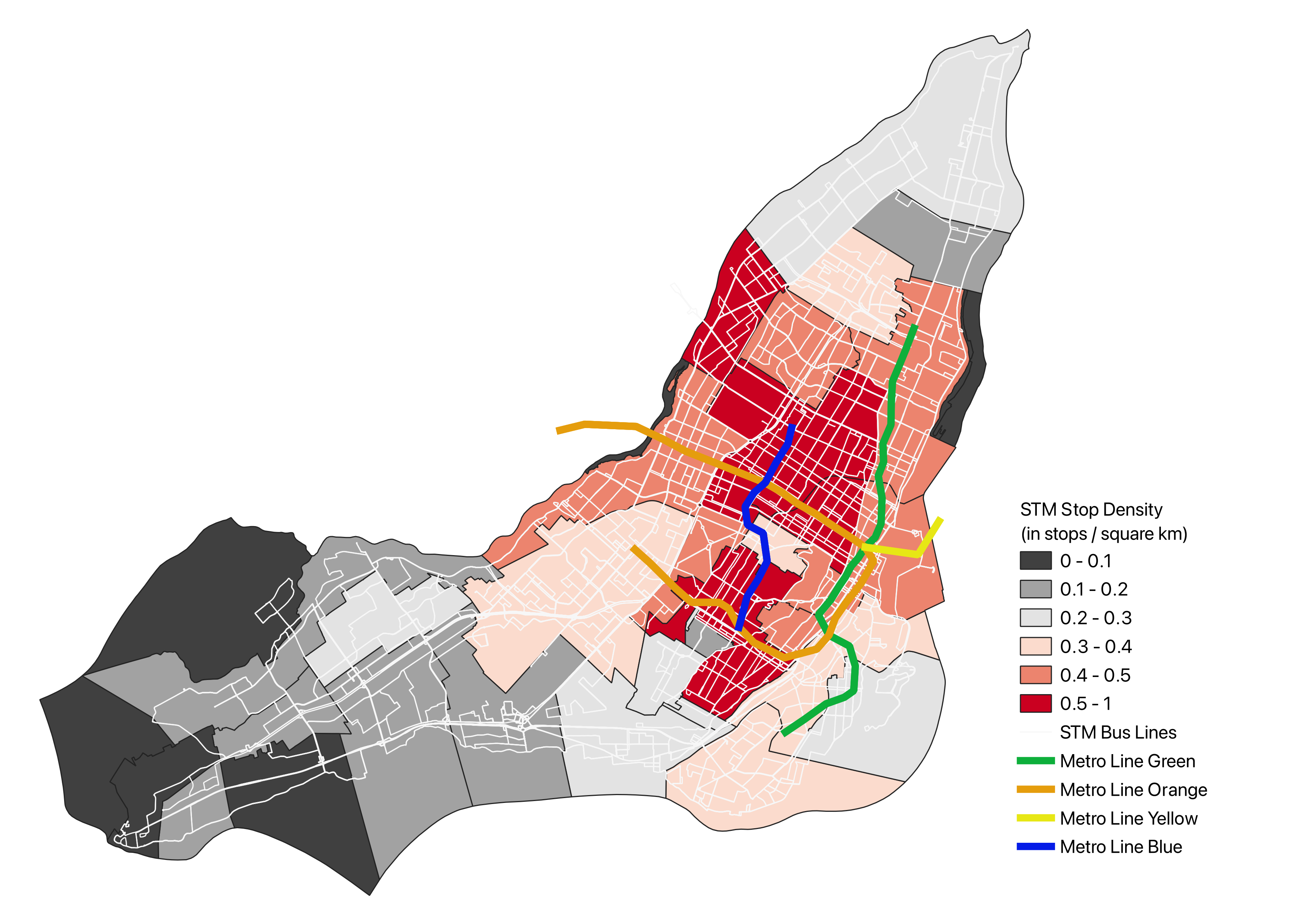
Made in QGIS
What if you needed to determine how many motorcycle crashes occured on major roads vs minor roads both in and out of urban cores in order to influence a policy decision?
On which roads are motorcycle crashes most common?
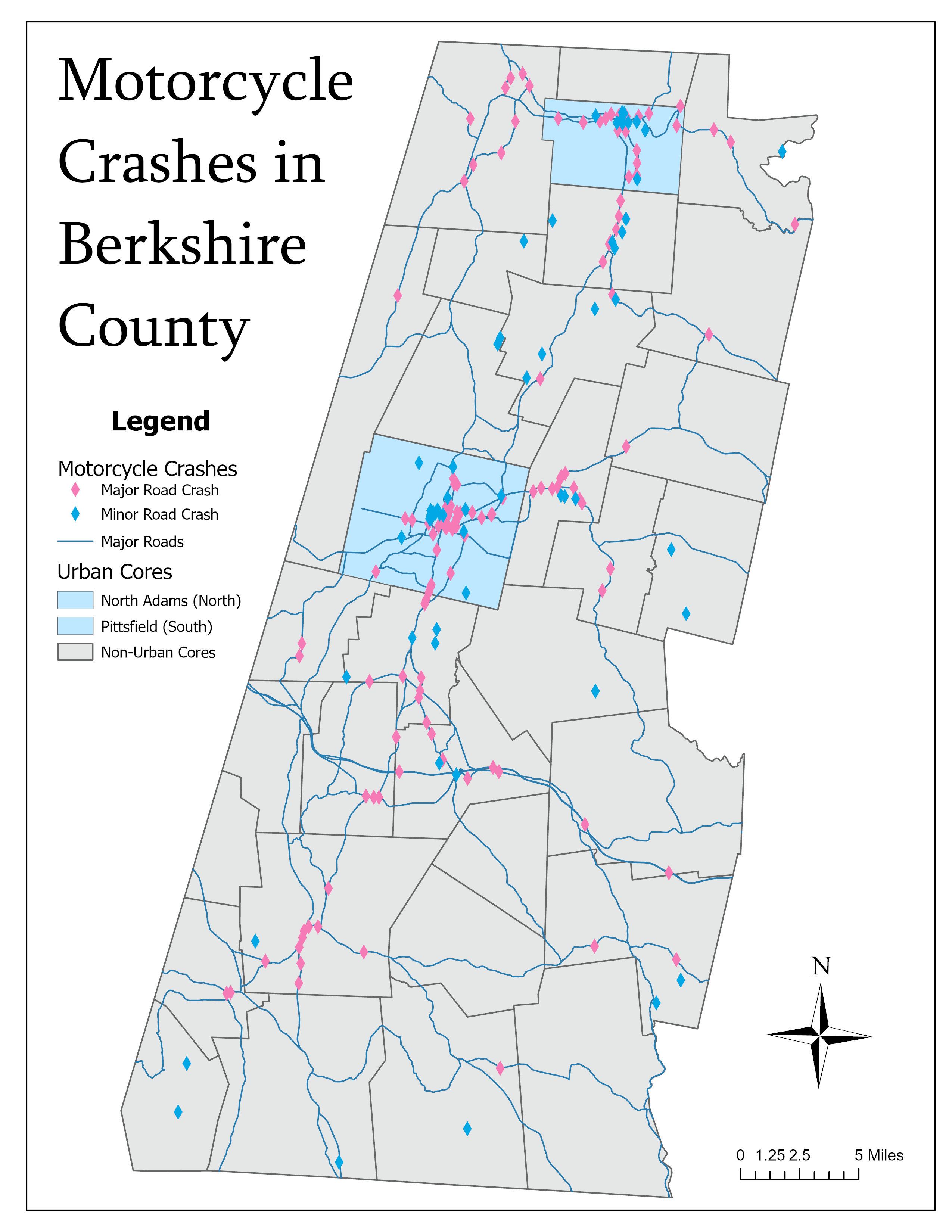
Made in ArcGIS Pro
What if you needed to determine the thickness and location of septic pipe infrastructure in relation to schools and parks for a new construction project?
Where are the thinnest and thickest diameter pipes located? Where are the schools and parks?
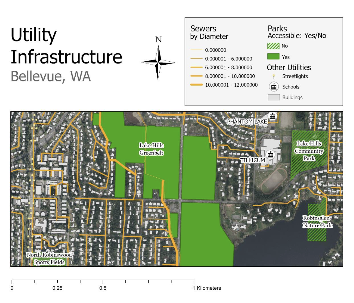
Made in ArcGIS Pro
What if you needed to determine which areas have the highest concentration of local businesses within reasonable travel distance?
How accessible are different census blocks to local business by travel time and business density?
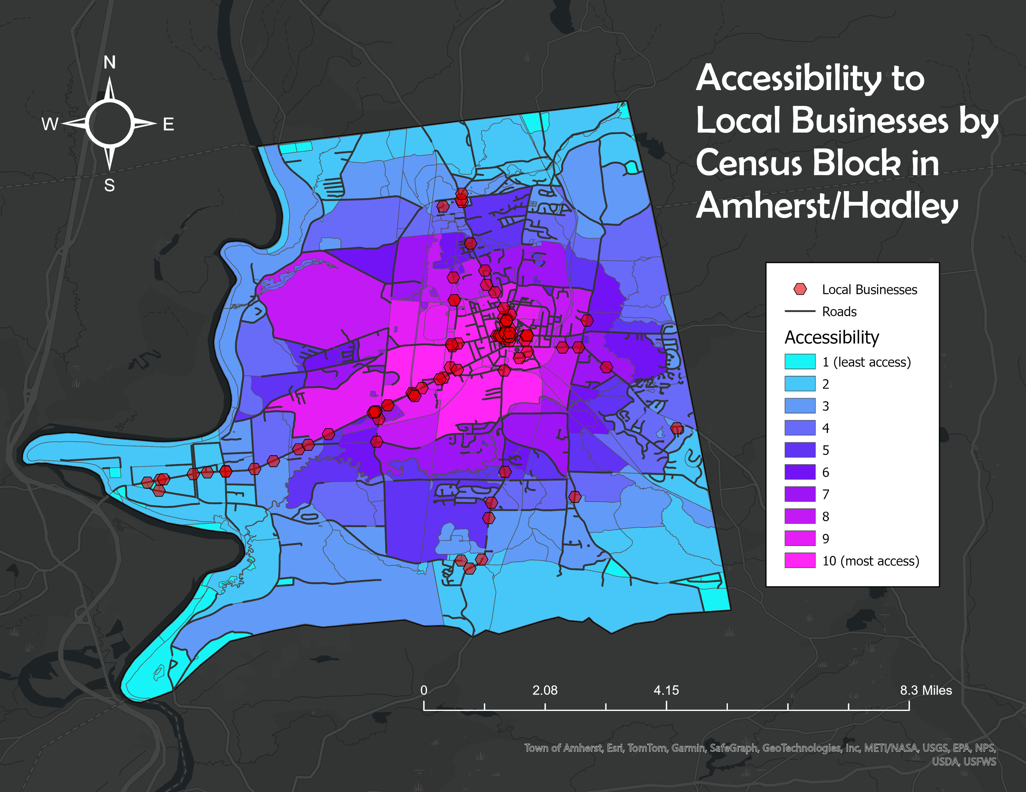
Made in ArcGIS Pro